
ISR UAV Systems Guide: Persistent Surveillance (2026)
Star United Flight Control (Shaanxi) Technology Co., Ltd.
9 min read·2026-09-17
Strategic Overview: Defining Persistent ISR UAV Systems
An Intelligence, Surveillance, and Reconnaissance (ISR) UAV system for persistent surveillance is an unmanned aircraft architecture engineered to deliver real-time actionable situational awareness over designated target areas for continuous operational cycles ranging from 4 hours to over 24 hours. These tactical platforms integrate stabilized multi-sensor Electro-Optical/Infrared (EO/IR) gimbals, onboard edge processing, and high-bandwidth tactical data links to provide persistent overwatch in austere environments. Modern defense integrators, border control authorities, and enterprise security directors face a structural shift in surveillance requirements. Legacy manned airborne assets impose unsustainable flight-hour operating expenses, while consumer-grade multirotors lack the structural integrity, wind tolerance, and payload capacity necessary for mission success. Enterprise-grade tactical unmanned aerial vehicles (TUAVs) engineered by manufacturers like Star United UAV bridge this gap. By leveraging advanced composite aerodynamics, hybrid propulsion lines, and open-architecture avionics, these platforms deliver theater-grade intelligence gathering at a fraction of traditional capital expenditures across demanding ISR and surveillance drone applications.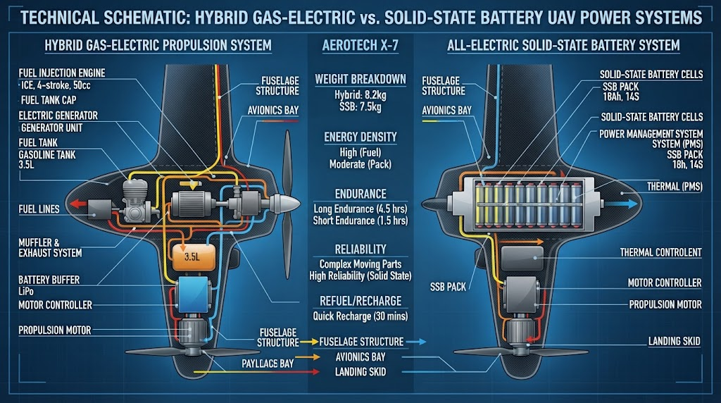
Standard Definition: According to NATO STANAG 4586 standards, tactical persistent ISR requires seamless interoperability between uncrewed air vehicles and Ground Control Stations (GCS) through standardized command architectures, delivering uninterrupted Level 3 to Level 5 payload telemetry to field commanders.
Airframe Architectures for Long-Endurance ISR Overwatch
Selecting the optimal airframe directly determines operational range, aerodynamic efficiency, launch footprint, and weather tolerance. Persistent surveillance demands airframes that minimize energy consumption during transit and loiter phases while maintaining high aerodynamic stability for optical tracking. Three primary platform configurations dominate tactical deployment programs:- Hybrid VTOL (Vertical Takeoff and Landing) Fixed-Wing: Integrates multirotor vertical lift with the aerodynamic cruise efficiency of fixed-wing flight. These platforms eliminate the need for runway infrastructure, catapult launchers, or arrestor nets, making them ideal for unimproved terrain, forward operating bases (FOBs), and maritime patrol vessels.
- Tethered Multirotor Systems: Connected directly to a ground-based continuous micro-tether power supply unit. They trade horizontal transit radius for virtually unlimited hover persistence (24/7 uninterrupted uptime) within fixed tactical perimeters.
- Heavy-Lift Rotary Systems: Multi-rotor platforms designed for localized, mid-duration overwatch (45–90 minutes). They provide high maneuverability in urban canyons and can carry multi-sensor pods exceeding 10 kg.
Propulsion & Power Systems: Maximizing Flight Duration
Endurance in persistent ISR is fundamentally governed by power density and specific fuel consumption (SFC). Pure battery-electric platforms offer zero direct emissions and near-silent acoustic signatures below 400 feet AGL (Above Ground Level), but are limited by energy densities around 250–300 Wh/kg. To overcome battery constraints in tactical ISR missions, hybrid-electric powertrains utilize heavy-fuel (EFI gasoline or kerosene/heavy-fuel) generator engines to charge high-discharge buffer batteries in flight while powering brushless electric pusher motors. This design yields flight times up to 6–10 hours with 3–5 kg payload weights.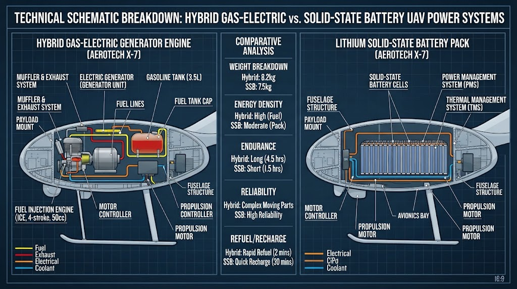
| Architecture | Typical Endurance | Max Payload (SWaP) | Acoustic Profile (500ft AGL) | Primary Mission Profile |
|---|---|---|---|---|
| Pure Electric Hybrid VTOL | 2.5 – 3.5 Hours | 2.0 – 5.0 kg | < 42 dBA (Near-Silent) | Covert ISR, urban reconnaissance |
| EFI Gas-Electric Hybrid VTOL | 6.0 – 10.0 Hours | 5.0 – 12.0 kg | 55 – 60 dBA (Low Muffled) | Border patrol, maritime EEZ, pipeline |
| Tethered Multirotor | 24+ Hours (Continuous) | 3.0 – 8.0 kg | 50 – 55 dBA | FOB base defense, event security |
| Heavy-Lift Rotary Multirotor | 45 – 70 Minutes | 10.0 – 25.0 kg | 65 – 72 dBA | Multi-sensor DVE tactical scanning |
Sensor Payload Integration: SWaP Optimization & Sensor Fusion
In persistent surveillance, the airframe is simply the delivery vehicle; operational value relies entirely on the integrated sensor suite. Every gram of sensor weight and every watt of sensor power draw directly degrades flight endurance. Engineers evaluate payloads using SWaP-C metrics (Size, Weight, Power, and Cost). Modern ISR configurations combine multiple sensor modalities into a single gyro-stabilized gimbal:- Electro-Optical (EO) Sensors: High-definition (4K) visible spectrum cameras equipped with continuous optical zoom (30x to 60x) and electronic image stabilization (EIS) for daytime long-range target identification (ID).
- Cooled MWIR vs. Uncooled LWIR Thermal Imaging: Uncooled Long-Wave Infrared (LWIR) sensors (8–14 µm) offer low weight and rapid startup, but Cooled Mid-Wave Infrared (MWIR) sensors (3–5 µm) provide superior thermal sensitivity (NETD < 20 mK), allowing identification of human targets beyond 5 km in zero-light and adverse weather conditions.
- Eye-Safe Laser Rangefinders (LRF): Class 1 eye-safe LRFs (1550 nm) calculate precise target GPS coordinates (geo-location) out to 10 km when paired with onboard inertial measurement units.
- Synthetic Aperture Radar (SAR): Compact strip-map and spotlight SAR units penetrate smoke, dust, cloud cover, and foliage where optical sensors fail in Degraded Visual Environments (DVE).
The Star United UAV 'PERSIST' Operational Framework
Procuring a tactical persistent ISR system requires balancing complex avionics, airframe dynamics, and logistics constraints. Star United UAV utilizes the proprietary PERSIST Framework to systematically design, validate, and integrate end-to-end tactical systems.- P – Platform Selection: Match airframe aerodynamics (VTOL vs. Tethered vs. Multirotor) to runway limitations, operational terrain, and theater transit distances.
- E – Energy Architecture: Calculate fuel/battery capacity curves against target loiter durations, factoring in worst-case headwinds and ambient thermal extremes (-20°C to +55°C).
- R – Real-Time Telemetry: Integrate high-integrity tactical C2 protocols with STANAG 4586 compliance to deliver seamless telemetry across multi-node defense networks.
- S – Sensor Fusion: Configure co-aligned EO, MWIR/LWIR, and SAR payloads inside SWaP-optimized multi-axis stabilized gimbal assemblies.
- I – Intelligence at the Edge: Deploy low-power AI microprocessors to execute real-time automated target recognition (ATR) directly aboard the aircraft.
- S – Secure Tactical Links: Implement AES-256 encrypted COFDM/FHSS data links with automatic beam-steering to eliminate jamming vulnerabilities.
- T – Total Cost Modeling: Establish predictable lifecycle maintenance budgets, spare parts provisioning ratios, and pilot operational curricula.
Command, Control & Secure Communications Architecture
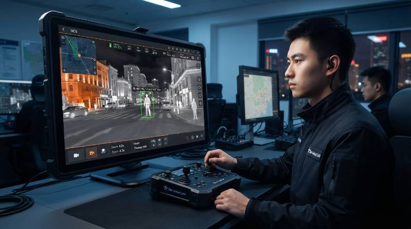
Long-endurance persistent surveillance is ineffective without uncompromised, low-latency command, control, and intelligence distribution channels. Modern tactical deployments require robust communication architectures designed to withstand electronic warfare (EW) and signal degradation. Key communications layers include:- Line-of-Sight (LOS) COFDM Data Links: Direct point-to-point microwave tactical data links operating across C-band, S-band, or dual-band frequencies. These systems deliver up to 50 Mbps throughput across 50–150 km with AES-256 hardware encryption.
- BVLOS SATCOM Integration: Compact Ku/Ka-band satellite communication terminals enabling global command, control, and real-time H.265 video streaming when the aircraft operates well beyond terrestrial radio horizon limits.
- Anti-Jamming & FHSS Telemetry: Frequency-Hopping Spread Spectrum (FHSS) modulation that dynamically cycles radio frequencies hundreds of times per second across wide RF bands to bypass localized tactical jamming efforts.
Edge AI & Autonomous Target Tracking in Contested Environments
In bandwidth-constrained or EW-contested theaters where tactical data links are degraded, modern ISR platforms rely on onboard edge neural computing modules. Embedded edge AI processors execute Convolutional Neural Networks (CNNs) directly on high-framerate optical feeds. This edge processing enables automated target classification (distinguishing between human, vehicle, and vessel signatures), continuous optical target locking, and automated coordinate handoff. In GPS-denied environments, onboard Visual Inertial Odometry (VIO) and optical flow navigation maintain accurate spatial positioning without satellite reliance.Critical Application Scenarios: Defense, Border & Enterprise Security
Persistent ISR systems solve specific operational challenges across high-stakes domains:1. National Border Overwatch & Anti-Smuggling
Hybrid VTOL platforms conduct pre-programmed autonomous perimeter patrols along mountainous and desert border segments. Equipped with cooled MWIR gimbals, they detect human border crossings up to 8 km away, feeding real-time geolocations to ground interception units.2. Maritime Exclusive Economic Zone (EEZ) Monitoring
Naval and coast guard operations use heavy-fuel hybrid UAVs launched from vessel helipads to track illegal fishing, monitor sea-lane chokepoints, and conduct rapid Search and Rescue (SAR) sweeps in rough sea states.3. Critical Infrastructure & Energy Corridor Patrols
Industrial security teams deploy customized perimeter security and patrol solutions to safeguard oil refineries, utility pipelines, and nuclear generation facilities against intrusion and sabotage.Total Cost of Ownership (TCO) and Lifecycle Maintenance Analysis
Procurement officers frequently make the critical mistake of evaluating ISR platforms solely on upfront acquisition CapEx. In persistent tactical operations, initial procurement accounts for only 30% to 40% of the total 5-year lifecycle expenditure. A rigorous TCO calculation includes:- Cost Per Flight Hour (CPFH): Aggregates engine overhaul intervals, battery cycle degradation rates, fuel consumption, and recurring software licensing. High-reliability tactical VTOL platforms average $80 to $250 per hour, compared to $1,500+ per hour for light manned aircraft.
- Mean Time Between Failures (MTBF): Industrial-grade avionics, triple-redundant autopilot systems, and brushless servos designed for 1,500+ hours MTBF significantly reduce operational downtime.
- Modular Sensor Upgrades: Utilizing standardized payload interfaces (e.g., universal quick-release mechanical collars and standard IP protocols) protects capital investments by allowing operators to upgrade sensor gimbals without replacing the core airframe.
Procurement Evaluation Checklist for Security & Defense Buyers
Use the following technical specification matrix to evaluate tactical ISR UAV tenders and vendor proposals:| System Parameter | Minimum Acceptable Baseline | Tier-1 Tactical Standard (Star United UAV) |
|---|---|---|
| Flight Endurance (Loiter) | > 2.5 Hours (Battery) | 6.0 – 10.0+ Hours (Hybrid EFI / Tethered 24h) |
| Thermal Sensitivity (NETD) | ≤ 50 mK (Uncooled LWIR) | ≤ 20 mK (Cooled MWIR Continuous Zoom) |
| Data Link Encryption | AES-128 Software | FIPS 140-2 Validated AES-256 Hardware + FHSS |
| Wind In-Flight Tolerance | Beaufort Scale 5 (≤ 10 m/s) | Beaufort Scale 7 (≤ 17.5 m/s or 35 knots) |
| Autopilot Redundancy | Single IMU / Single Magnetometer | Triple Redundant IMU + Dual GPS RTK / VIO |
| Ingress Protection Rating | IP43 (Light Mist) | IP55 / IP67 Fully Sealed All-Weather Composite |