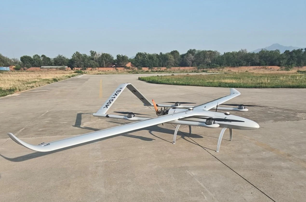
Persistent Eyes.
Everywhere. Always.
Star United Flight Control's long-endurance VTOL platforms carry EO/IR, SAR radar, LiDAR, and communication relay payloads for 5–7 continuous hours — providing persistent intelligence, surveillance, and reconnaissance coverage across land, border, and maritime domains.
Six ISR Domains,
One Integrated Platform
Wide-Area Persistent Surveillance
Long-endurance VTOL fixed-wing platforms provide 5–7 hour continuous coverage of wide operational areas. EO/IR sensor turrets deliver real-time HD video and thermal imagery across a 10–50 km² surveillance footprint per sortie.
Recommended Platforms
Key Parameters
Border Security & Perimeter Monitoring
24/7 automated border surveillance with AI-assisted intrusion detection. Long-endurance platforms maintain persistent coverage of extended border segments, automatically alerting operators to detected movement and transmitting geo-referenced imagery for rapid response coordination.
Recommended Platforms
Key Parameters
Maritime Patrol & Sea Surface Surveillance
Long-range maritime surveillance for exclusive economic zone monitoring, illegal fishing detection, smuggling interdiction, and sea surface search and rescue. VTOL platforms operate from ship decks without catapult or recovery systems.
Recommended Platforms
Key Parameters
Target Acquisition & Battle Damage Assessment
Real-time target identification, geo-location, and post-strike battle damage assessment. The SG GCS integrates ISR sensor feeds with fire control systems to close the Sense-Plan-Strike-Assess loop, enabling rapid re-engagement decisions based on live BDA imagery.
Recommended Platforms
Key Parameters
Communication Relay & BLOS Operations
VTOL platforms equipped with communication relay payloads extend operational range for ground forces and other UAVs operating beyond direct radio line-of-sight. Relay nodes can be pre-positioned or dynamically repositioned to maintain continuous data links across complex terrain.
Recommended Platforms
Key Parameters
Aerial Mapping, Photogrammetry & LiDAR Survey
High-precision aerial mapping for military terrain analysis, post-disaster damage assessment, urban planning, and infrastructure documentation. LiDAR and photogrammetry payloads generate centimeter-accurate 3D models and orthomosaic maps compatible with standard GIS workflows.
Recommended Platforms
Key Parameters
Mission-Configurable
Sensor Suite
All VTOL platforms feature modular payload bays supporting rapid sensor swaps between missions. Six sensor options cover every ISR requirement — from tactical EO/IR surveillance to SAR all-weather radar and precision LiDAR mapping.
View VTOL Platform SpecsEO/IR Dual-Band Turret
Continuous zoom EO + uncooled thermal IR, 4K video, stabilized gimbal
SAR Synthetic Aperture Radar
All-weather, day/night ground imaging, GMTI moving target indicator
LiDAR Mapping Sensor
High-density point cloud, 200+ pts/m², centimeter-level accuracy
Communication Relay Payload
UHF/L-band relay transponder, multi-link simultaneous operation
Multispectral Camera
5-band multispectral for agricultural, environmental, and damage assessment
SIGINT / Electronic Intelligence
RF signal collection and geolocation, spectrum monitoring
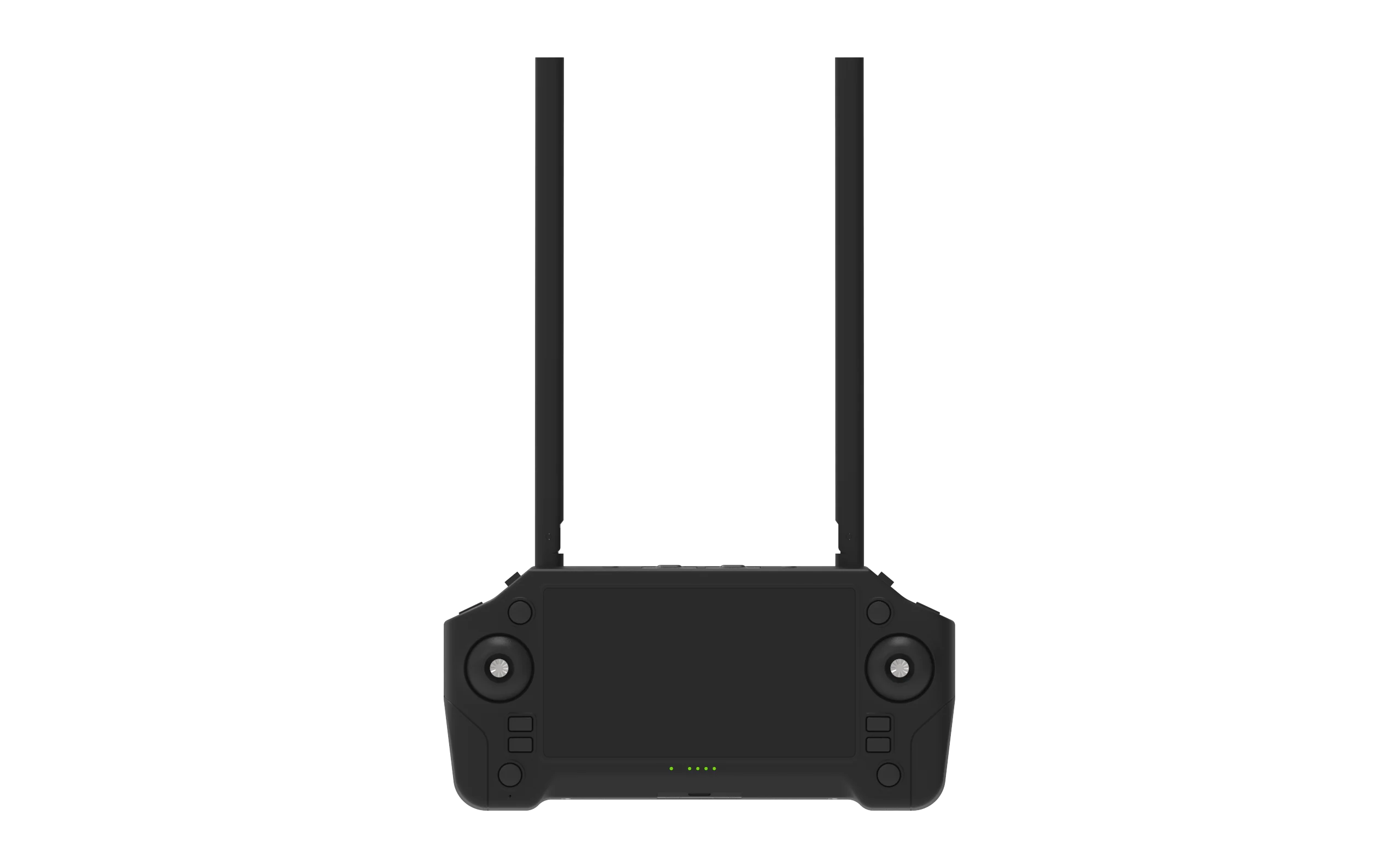
SG GCS — Closing the
Sense-Plan-Strike-Assess Loop
The SG Ground Control System integrates ISR sensor feeds from multiple VTOL platforms with fire control systems and ground forces. AI-assisted target recognition, automatic geo-location, and real-time BDA enable rapid decision cycles in complex operational environments.
Design Your ISR
Surveillance System
Our ISR systems engineers provide tailored sensor and platform configuration for your specific surveillance requirements, coverage area, and operational environment. Contact us for technical consultation and procurement support.
Define Your ISR
Surveillance Requirements
Our ISR systems engineers provide tailored sensor and platform configuration for your specific surveillance domain, coverage area, and operational environment. Submit your requirements and receive a detailed technical proposal within 48 hours.